Press Release:
The public is invited to participate in biomonitoring surveys of bird and fish populations on the Land Trust for the Little Tennessee’s (LTLT) Welch Farm along the Valley River in Cherokee County on Saturday, July 19, starting at 9:00 am. LTLT’s Welch Farm is a 57-acre property along US Hwy 74 approximately 3 miles west of the Town of Andrews. Signs will direct the public to a parking area.
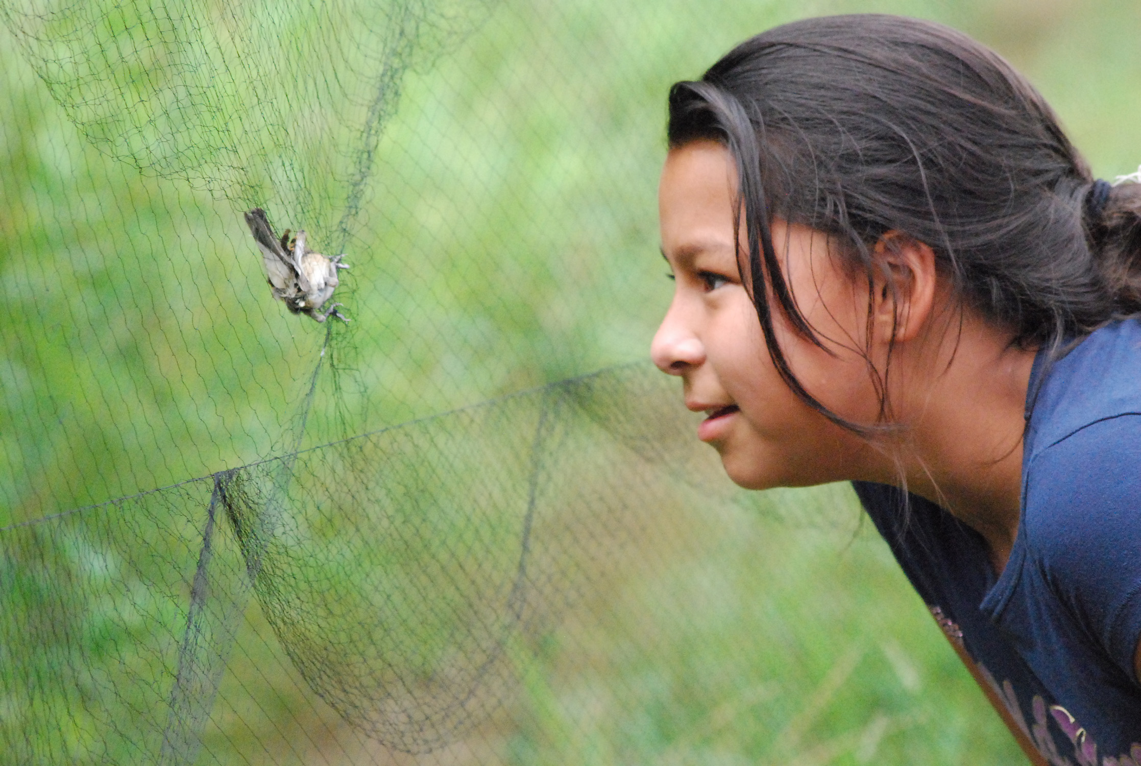
Designed for children and adults of all ages, the half-day event includes two activities that showcase nationally-recognized research work that monitors the health of both birds and fish. Participants will provide hands-on assistance in all aspects of the survey work under with training and supervision from LTLT and Southern Appalachian Raptor Research (SARR) field biologists.
The bird monitoring work is based on the Monitoring Avian Productivity and Survivorship (MAPS) protocol. MAPS is a nationwide program coordinated by the Institute for Bird Populations in Point Reyes, CA. The MAPS program includes a continent-wide network of over 500 mist netting stations and is designed to monitor productivity, survivorship, and population trends of breeding birds throughout North America. Analyses of the resulting banding data provide critical information relating to the ecology, conservation, and management of North American landbird populations, and the factors responsible for changes in their populations. For four years, SARR has been conducting bird monitoring surveys in Macon County at LTLT’s Tessentee Bottomland Preserve and the Eastern Band of Cherokee Indians’ (EBCI) Cowee Mound property.
The second activity is modeled after LTLT’s highly-successful stream biomonitoring program in the Little Tennessee River valley. The program, which focuses on fish as indicators of watershed health, is currently celebrating its 25th anniversary. Since the program began in 1990, more than 2,000 volunteers have participated in monitoring across more than 150 sites, generating the largest fish-based biomonitoring database in the world for any comparably-sized watershed. LTLT acquired the Welch Farm in 2011 to protect its rich farmland, scenic views, waters (including almost a mile of the Valley River) and diverse fish and wildlife habitat. The property is open to the public for fishing, boating, walking, and nature observation.
This event is a result of a partnership between LTLT, SARR, and EBCI’s Fisheries and Wildlife Management program. The program is sponsored by the Cherokee Preservation Foundation’s Revitalization of Traditional Cherokee Artisan Resources (RTCAR) initiative, the Eastern Band of Cherokee Indians, North Carolina State University, and the Coweeta Long Term Ecological Research program.
For more information, please contact [email protected] or call (828) 736-1217.