Mainspring Conservation Trust

Stewards of the Southern Blue Ridge

eNews Sign-upDonate
  • About
    • Our Story
    • Board of Directors
    • Our Staff
    • Our Projects
    • News
    • Publications
  • What We Do
    • Where We Work
    • What Is A Land Trust?
    • Land Conservation
    • Brownfield Remediation
    • Stream Restoration
    • Youth Environmental Education
    • Aquatic Biomonitoring
    • Cultural Heritage
    • WNC Wildseed Library
      • Wildseed Library FAQs
  • Get Involved
    • Conserve Your Property
    • Events
    • Get Outside
    • Visit Our Properties
    • Volunteer
    • Ways to Support
  • Contact

New Parking Lot Offers Access to Public Lands

June 10, 2019

Volunteers help place bollards and install bumpers in the parking lot in southern Macon County.

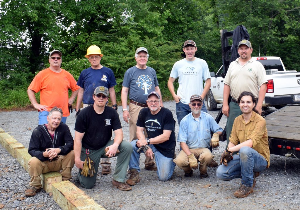
Access to the Bartram Trail in southern Macon County just got a little easier through a partnership with Mainspring Conservation Trust, the U.S. Forest Service, NC Wildlife Resources Commission, and the NC Bartram Trail Society.

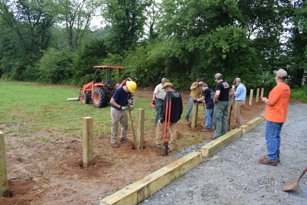
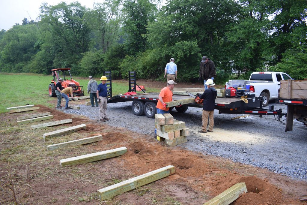
A new parking lot now sits directly across Hickory Knoll Road from the relatively new Bartram Trail trailhead. The gravel lot is on a portion of 72 acres Mainspring purchased in 2018 that borders Nantahala National Forest lands to the east and North Carolina Needmore Game Lands across the Little Tennessee River to the west. USFS prepared the site, the NCWRC delivered and spread gravel for the parking lot, and Mainspring and Bartram Trail volunteers placed bollards and installed bumpers to define the parking spaces.

Mainspring Executive Director Sharon Taylor says the parking lot is great for all outdoor enthusiasts. “It’s wonderful to have the lot available for Bartram Trail hikers, but also to fisherman and hunters who want to take advantage of Mainspring’s publicly assessable land and the Forest Service lands adjacent to the property.”

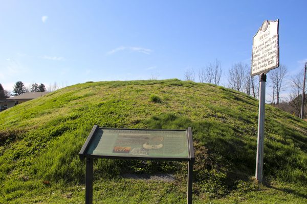
An informational kiosk and some landscaping, including native plants encountered by explorer and naturalist William Bartram during his 1770’s travels through the region, are also planned for the area.

Filed Under: News, Press Room Tagged With: fishing, hiking, hunting, Macon County, public access

Cherokee One Feather: Mound deed to be transferred to Nikwasi Initiative

May 8, 2019

By Scott McKie May 8, 2019

The Nikwasi Initiative non-profit organization will soon have the deed and responsibility over a sacred Cherokee mound in Macon County.  Following unanimous approval by the Franklin Town Council on Monday, May 6, the Town of Franklin will transfer the deed for the Nikwasi Mound to the non-profit.

The Nikwasi Initiative is a partnership between the Town of Franklin, the Eastern Band of Cherokee Indians (EBCI), Macon County, and the Mainspring Conservation Trust.

“This project has enormous potential for the town and the region,” Barbara McRae, Franklin vice-mayor and co-chair of the Nikwasi Initiative, said in a statement.  “Its history is fascinating and unique.  It has meaning to all of us in Macon County, as well as the Cherokee, and is a treasured part of our heritage.  And, it has national significance.  We look forward to the opportunity the coalition offers to tell this story and create a beautiful public place around it.”

The Nikwasi Mound is a site sacred to the Tribe and was put on the National Register of Historic Places in 1980, being listed there as Nequasee.

Principal Chief Richard G. Sneed said in a statement to the One Feather, “I am very pleased that the Franklin Town Council voted unanimously to convey Nikwasi Mound to the Nikwasi Initiative.  The vote by the Town Council solidifies the partnership between the Eastern Band of Cherokee Indians, the Town of Franklin, and the Nikwasi Initiative. We are very excited about what the future hold for all the partners in this venture.”

Officials from the Nikwasi Initiative stated that following the deed transfer, their organization “will coordinate with EBCI’s Tribal Historic Preservation Office regarding mound maintenance”.

Juanita Wilson, an EBCI tribal member and co-chair of the Nikwasi Initiative, said in a statement, “I woke to the news of the unanimous vote.  My heart skipped a beat.  I could hear my ancestors sigh.  In my mind’s eye, I can see the Nunnehi, the ‘immortals’, who historically protected these lands, and the people, nodding in approval.  I felt the winds shift, bringing a sense of renewal and unity across western North Carolina.  I woke up to a new day.”

Deputy Director of Mainspring Conservation Trust Ben Laseter said in a statement, “Last night’s unanimous decision was wonderful.  It showed the Town’s confidence and commitment to the partnership and to revitalization of the Nikwasi area.  Just as it took several years to get where we are now, it will take time to secure the resources needed to fully realize the potential of Nikwasi as a world-class interpretive site.”

During a Franklin Town Council meeting on April 1, a total of 19 people spoke on the subject that originated after the Council voted to move forward with drawing up the new deed during their March meeting.

Gloria Raby Owenby, Macon County Historical Society former president, is one of five Macon County residents who have filed a complaint and injunction against any action transferring the mound’s deed.  During the April 1 meeting, she noted, “I feel very strongly in honoring the deed.  The language clearly states that the Nikwasi Mound belongs to all citizens.  I will not waver to protect it for generations to come.  The Town has been a good steward.  The mound is basically the same as it was for 73 years.”

As of press time, no action has been taken on the complaint and injunction.

The deed, signed and enacted on Oct. 7, 1946, states in part, “The mound situated upon the property above described shall be preserved for the citizens of Macon County and for posterity, and the same shall be kept as it now stands and shall not be excavated, explored, altered, or impaired in any way or used for any commercial purpose, and shall be kept as a monument to the early history of Macon County…”

In August 2018, the EBCI Tribal Council approved legislation to purchase a 0.59 acre tract of land that sits adjacent to the Mound from the Mainspring Conservation Trust for $400,000.  Prior to ratifying that legislation, Chief Sneed said, “This is an opportunity for the Eastern Band, in partnering with Mainspring Conservation and Macon County and the Town of Franklin, for the Eastern Band to acquire cultural and historic lands that were our aboriginal homelands.  The long-term plan is to create a cultural corridor that preserves and protects historic sites for the Eastern Band, and this is just one more step in a long process that will continue until all of our lands that are important to us are protected and preserved.”

Russell Townsend, EBCI tribal historic preservation officer, gave the One Feather a brief historical account of the site previously stating, “Nikwasi Mound is a Missippian Period mound that is likely 800 to 900 years old.  It was built by ancestors of modern Cherokee people, and several ancient Cherokee stories are associated with it.  The best known story is that of the ‘spirit warriors’ who come from inside the mound to protect the community in time of need.  It is said that happened in pre-Colonial times as well as during the American Civil War.”

Filed Under: News Tagged With: conservation, Cultural Heritage, Macon County, Nikwasi Initiative

Macon County News: A walk in the woods doubles as a history lesson at Tessentee Preserve

April 12, 2019

By Deena C. Bouknight – Contributing Writer
April 11, 2019

Macon County abounds with walking, hiking, and biking trails. But not all offer cultural significance. Yet, a walk through Tessentee Bottomland Preserve, less than eight miles from Franklin’s Main Street, offers up a diverse nature experience but with plenty of historical elements as well.  

Light hiking opportunities exist at Tessentee Bottomland Preserve, and there is much to see.

Mainspring Conservation Trust, formed in 1997 as a land and waters restoration and conservation entity, acquired a 70-acre tract in 1999. This Little Tennessee Valley area – where Tessentee Creek joins the Little Tennessee River – is now preserved not only for its varied habitats but also because of the noteworthy history that occurred here. 

Cherokee once thrived in the area, and the river valley was a busy trading route. Plus, the first battle of what became known as the “Cherokee Wars” is thought to have occurred at the site in 1760. Then, in 1775, famed naturalist and explorer William Bartram spent the night in a trader’s hut documented to be at “the foot of the Tessentee,” which is near or at the site of the present-day Tessentee Bottomland Preserve. 

But the tangible history that still exists on the site is the remains of a white settlement dating back to the early 1800s. 

Whipple Carpenter Smart and his wife Mary Louise Silver farmed this land for many years. In the photo on the left, made in 1912, they are pictured with their three children: (from left) John Thomas Sr., Furman, and James Earl. Visitors to Tessentee Bottomland Preserve can take a footpath to see the historic homestead.

Belinda Carringer, whose Carringer Farms’ fresh produce, honey, jams, eggs, and more are offered at the Saturday morning Franklin Farmer’s Market, knows the farm as that of her great-great grandfather’s. A 1912 black and white photograph was given by Carringer to Mainspring and is on display at the farmhouse. Taken in front of the house, the photo includes Whipple Carpenter Smart (1867-1946), his wife Mary Louise Silver (1871-1918), and their children, including Carringer’s grandfather, John Thomas Smart Sr., who sits astride a mule. (Interestingly, her great-grandmother’s death became a statistic of the historic 1918 flu pandemic that killed up to 100 million people globally, with at least 14,000 deaths in North Carolina.) 

Surrounding the two-story wood farmhouse with rough-hewn porch posts is an outhouse, chicken coop, root cellar, and smokehouse. Farm equipment, including a seeder, exists on the property as well. 

Carringer, whose maiden name is Smart and whose father was John Thomas Smart Jr., said she knew the farm existed, but her great aunt Emma Smart was unable 20 years ago to remember where. Carringer became passionate about finding it. 

“I’ve been doing my genealogy for 25 years,” said Carringer. “We tried to find the old home place but my Aunt Emma couldn’t remember exactly where it was because she was getting very old.  One day, when my husband and I were walking on the Mainspring property, looking at all that they had done [for the Preserve], we stumbled across the old home place.  My Aunt Emma had told me the general direction of the home place, and I knew it was close by. She told me if I ever found a silo with an old house, that would be it. When we saw the house, along with the silo, I knew it was it. I got down on my hands and knees and cried. The house means so much to me, and I’m so thankful to Mainspring for restoring it.”

The area was originally known by settlers as Smithbridge Township, so named for the original owner, Samuel Smith, who acquired the property by state grant. The existing farmhouse dates from the 1890s and the farm was in operation as a dairy as late as the early 1990s, according to Mainspring’s research.  

An old fashioned “can house” or root cellar sits on the property. The can house was where families would store their canned vegetables they had put up from their gardens. Note a portion of the can house is underground, keeping the contents cool and protected from the elements.

Further, an old wagon road once passed between the house and the root cellar. 

“I think it’s very, very important to have nature preserves that also provide historical and cultural information,” said Carringer. 

Besides viewing the historic farm, visitors to Tessentee Bottomland Preserve have an opportunity to learn about various trees through educational ID tags; white oaks, black cherry, black walnut, sycamore, and black locust are some of the more common trees in either the wetter bottomlands or along the bluffs, but there are also some trees unusual to Macon County, such as blackjack oaks and shortleaf pines. A narrow foot trail from the parking area winds down through lily and daffodil beds that once surrounded a four-room cabin which was torn down in 2005. A spring feeds a meandering creek along the footpath. A stand of rivercane, which is one of North America’s three native bamboo species, is also there. Artisans from Qualla Arts & Crafts Mutual of the Eastern Band of the Cherokee harvest periodically the cane for crafting such items as baskets.  

“It’s just such a unique piece of property with so many micro habitats in that small part of land,” said Mainspring’s Executive Director Sharon Taylor. “It’s a special place, with seven different soil types, 129 bird species, and 56 butterfly species identified so far. Getting outside and appreciating nature is so important. You go from one area to another on the Preserve and each part is so different.” 

Taylor said she is encouraged that activities such as Migration Celebration, which helps children to understand the cultural heritage and natural resources of the area, are held at the Preserve.  

“I love the fact that there are demonstrations held at the old house every year for school kids to come to see how things were in that era,” said Carringer. “Volunteers demonstrate things like basket weaving, bread baking, quilt making, etc. I have been asked to demonstrate there and I am looking forward to going and telling the school children that my ancestors owned this house.”

Although the doors of the home are locked because of needed repairs inside, Mainspring’s goal is to accumulate enough funding to restore the interior so that it can be opened to the public. 

Tessentee Bottomland Preserve is open free to the public and located at 2249 Hickory Knoll Road.

Filed Under: News Tagged With: conservation, Macon County, news

  • « Previous Page
  • 1
  • 2
  • 3
  • 4
  • 5
  • Next Page »

E-Newsletter Sign-Up

  • Facebook
  • Instagram
  • Twitter
  • Vimeo
557 East Main Street
Franklin, NC 28734
828-524-2711

© Copyright 2025 · All Rights Reserved.