Mainspring Conservation Trust

Stewards of the Southern Blue Ridge

Buy MerchDonate
  • About
    • Our Story
    • Board of Directors
    • Our Staff
    • Our Projects
    • News
    • Publications
  • What We Do
    • Where We Work
    • What Is A Land Trust?
    • Land Conservation
    • Brownfield Remediation
    • Stream Restoration
    • Youth Environmental Education
    • Aquatic Biomonitoring
    • Cultural Heritage
    • WNC Wildseed Library
      • Wildseed Library FAQs
  • Get Involved
    • Conserve Your Property
    • Events
    • Get Outside
    • Visit Our Properties
    • Volunteer
    • Ways to Support
  • Contact

Mainspring and OSI Save More than 4,400 Acres Across the Snowbird, Unicoi and Cheoah Mountain Ranges

June 2, 2026

Snowbird Effort Yields Wealth of Benefits for Recreation, Wildlife, and Clean Water

CHEROKEE, GRAHAM, AND SWAIN COUNTIES, N.C. (June 1, 2026) – Open Space Institute (OSI) and Mainspring Conservation Trust (Mainspring) have announced the conservation of more than 4,400 acres across the Snowbird, Unicoi and Cheoah mountain ranges. The multi-year project comprises a patchwork of 17 parcels connecting more than 1.65 million acres of ecologically rich public lands in a region of national conservation significance.  

Photo: Mac Stone, OSI

Long regarded by the State of North Carolina and the U.S. Forest Service (USFS) as a top conservation priority, this assemblage forms crucial connections among protected landscapes that stretch across three states. With shared boundaries, connected trails and viewshed impacts, this conservation project enhances protections for the Snowbird Wilderness Study Area, the Cherohala Skyway, and the Appalachian Trail.

Mainspring Executive Director Jeremy Hyatt said the effort has been years in the making. “These properties were among the most significant remaining private lands in the Southern Blue Ridge,” he said. “After nearly a decade of effort, securing them together is a big win for clean water, wildlife, and mountain heritage. We’re grateful to our partners at OSI and the many funders who helped make it possible.”

“The rugged and beautiful Snowbird project perfectly demonstrates ‘how’ and ‘why’ OSI is showing up in the southern Appalachian region,” said Dr. Maria Whitehead, OSI’s Senior Vice President of Land. “The project protects critical natural resources while providing exceptional new recreational opportunities and could only have been accomplished with savvy partners and dedicated funders. We are extraordinarily grateful to Mainspring, the Wildlife Resource Commission, USFS and our funding partners because this landscape deserves nothing less than our best efforts!”

Photo: Mac Stone, OSI

The Snowbird properties had been increasingly threatened by encroaching development. OSI and Mainspring completed the $23.3 million acquisition in early 2026, and will transfer the properties to the State of North Carolina and the USFS between 2026 and 2029. The properties will not be open to the public until transferred and prepared for public use, but once under state and federal ownership and management, traditional recreational uses like hunting and fishing will be preserved.

The North Carolina Wildlife Resources Commission (NCWRC), which manages more than two million acres across the state, commended Mainspring and OSI on the project. “The protection of the Snowbird properties is a remarkable achievement that strengthens the entire region of conserved lands,” said Tom Berry, Chairman of the Land Acquisition and Property Committee for NCWRC. “We commend the Open Space Institute and Mainspring Conservation Trust for their leadership and for laying the groundwork for expanded wildlife-associated recreation opportunities. Through the stewardship of the Commission, these lands will be opened to everyday people to enjoy hunting, fishing, birdwatching, and a wide range of outdoor activities, ensuring they remain a vital part of North Carolina’s outdoor heritage for generations to come.”

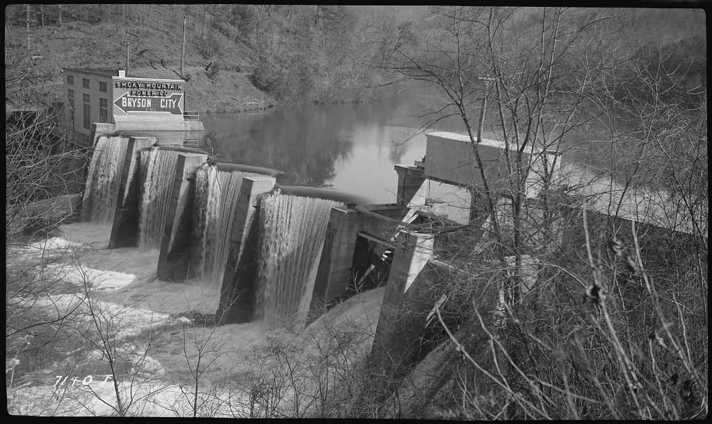
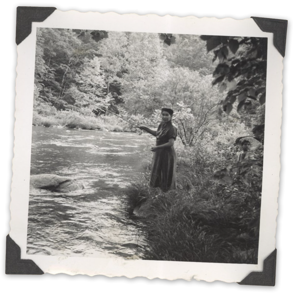
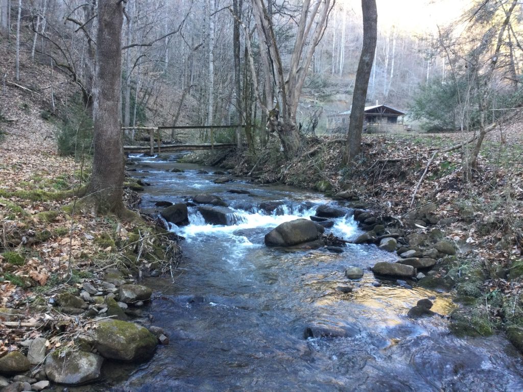
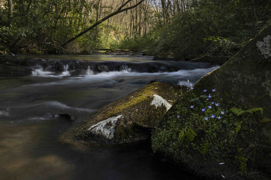
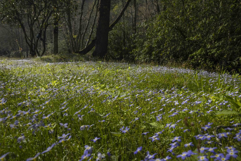
The Snowbird properties feature prominent ridgetops, healthy forests, open meadows and more than 17 miles of headwater streams that provide habitat for a diversity of flora and fauna. This landscape supports state- and federally endangered bat species, several threatened plant types, and species of conservation concern, including the Golden-winged Warbler. Abundant trout streams and high-quality waters protect aquatic habitat and provide clean drinking water for downstream communities, as several tracts lie within municipal water-supply watersheds. 

Photo: Mac Stone, OSI

As part of the Blue Ridge Mountains, the landscape contains some of the most biologically diverse forested regions in North America, home to thousands of native wildlife species and more than 100 tree species, including stunning eastern hemlock specimens. This region supports a vast corridor of intact wildlife habitat—the large, unfragmented blocks of land that are essential for species to migrate, thrive, and adapt to the impacts of extreme weather and changing weather patterns. According to OSI’s analysis, the area holds the highest rank possible for greenhouse gas emission absorption and storage: the landscape’s varied forest types and high-quality soils are a carbon stronghold, in addition to protecting wildlife food and water sources. Under the state’s management and stewardship, the properties will continue to perform these vital functions, providing cleaner air and supporting healthy ecosystems.

Support for the Snowbird conservation project came from the USFS Forest Legacy Program, Fred and Alice Stanback, Brad and Shelli Stanback, Knobloch Family Foundation, National Fish and Wildlife Foundation’s Acres for America Program, Mike Leonard, The Nature Conservancy, Ron Thurman, Appalachia Rising, Appalachian Trail Conservancy, Conservation Trust for North Carolina, OSI’s Appalachian Landscapes Program, NC Land and Water Fund, and the Foundation for the Carolinas.

Filed Under: News, Press Room Tagged With: App Trail, Cherokee County, conservation, Graham County, land conservation, land purchase, Snowbird, Swain County

Ode to Long Man: When Ela Dam is gone, its history will remain

November 24, 2025

This Tennessee Valley Authority photograph shows the dam and powerhouse in 1939, while leased to the Smoky Mountain Power Company.

For centuries, the Oconaluftee River has carried more than water through the valleys of Swain County. It has carried stories — stories of Cherokee towns, families who fished its bends and visitors who once filled its roadside motels. Now, as the Ela Dam nears the end of its life, archaeologists Paul Webb and Kaley Kelly are helping ensure those stories are not lost.

Webb and Kelly recently developed a public “storyboard” on the history of Ela and its river. The report, which has been submitted to the North Carolina Historic Preservation Office, is technically about the dam, but Webb views it differently. “Although the project is about the dam, it’s really about the river,” he says. “The dam is just a small blip in the history of the Oconaluftee. The water was here long before, and it will be here long after.”

Helen Bradley of the Eastern Band of Cherokee Indians fishing along the Oconaluftee River. Courtesy of Museum of the Cherokee People.

The Oconaluftee begins high in the Smokies before joining the Tuckasegee less than a mile south of the dam. Long before concrete and turbines popped up, it was free-flowing water that sustained fish, mussels, eels and people alike. The river provided food, passage and connection. Cherokee accounts describe the Oconaluftee as “Long Man,” a living being with a head in the mountains and feet in the sea. Another folk story, recorded in the late 1800s, spoke of “water bears” that lived in a deep pool within today’s Lake Ela. 

In the early 1900s, the Appalachian Railroad established a stop called “Ela,” a name some trace to the Cherokee word Elawodi, meaning “yellow hill.” A small, close-knit community soon formed along the tracks, with a church, bridges and later motels to serve tourists. At one point, entrepreneurs attempted to sell “lakefront lots” for vacation homes, but the idea never gained traction and Ela remained a very rural area.

For the people who lived there, the river was central. Kids swam and fished in its natural pools and families picnicked on its banks. Webb says he and Kelly heard from longtime residents who remember fishing holes so productive they became family traditions. Webb recalls a Cherokee elder mentioning she had made it her mission to teach her grandchildren how to fish in those same waters, keeping those traditions alive.

The dam, completed in 1925, provided electricity to the area but little identity. “I’m surprised in Swain County that I haven’t heard anyone say they shouldn’t take it down,” Webb says. “No one seems emotionally tied to the dam. Most people are tied to the river.”

As the dam fades into history, Webb and Kelly hope the storyboard will serve as a reminder that the river’s true power lies in the lives it touches. “Everybody is tied to the river one way or another,” he says. “The dam is just one chapter. The river is the whole story.”

See the full storyboard at arcg.is/1CuWHL3.

Filed Under: News, Press Room Tagged With: Ela Dam, history, North Carolina Historic Preservation Office, Oconaluftee River, Swain County

Renowned Artists Conserve Their Life’s Inspiration

December 21, 2022

The last private property that Lands Creek crosses before entering the Great Smoky Mountains National Park and the Tuckasegee River is now conserved, thanks to Swain County residents George and Elizabeth Ellison.

The Ellisons have lived there since 1976, discovering the property by accident while hiking an old wagon trail in the National Park. The couple thought they were still on public property until they stumbled upon an old shack and eventually convinced the owner to first rent, then purchase, the 38 acres adjacent to the National Park.

Elizabeth and George Ellison at home on Lower Lands Creek. Image credit: Quintin Ellison

The couple credits the land as a muse for both of their personal careers. George, a renowned regional naturalist and author of seven award-winning books, and Elizabeth, a skilled artist and teacher, both draw inspiration from the property that has cultivated a sense of place in their respective works. “Finding our personal sanctuary on Lands Creek was undoubtedly more important to our personal success than words can convey,” Elizabeth says. By permanently conserving the picturesque property, she and George hope to “pay back to the land what it has given to us.”

The sounds of Lands Creek can be heard on the back porch of the Ellison family home. This is the last private property before the creek flows in the Smoky Mountain National Park.

As they grew increasingly interested in permanently protecting the property, the Ellisons began discussing conservation easements with close friend Bill Gibson, and he suggested they speak with Mainspring. “I knew George and Elizabeth loved the land,” says Gibson, who sits on the Mainspring board of directors. Gibson was deeply instrumental in the 1999 Mainspring-led project that conserved the headwaters of Lands Creek, so he was excited to facilitate a project that would bookend the 1999 project with this 2022 one. “Conserving both ends of the creek is very meaningful,” he says.

Under the terms of the conservation easement, funded through a grant from the North Carolina Land and Water Fund, the private property will remain intact, keeping the house and outbuildings where the Ellisons live, garden, and maintain their own hiking trails. The easement will help protect the viewshed for portions of the GSMNP, the Nantahala National Forest, and portions of the Tuckasegee River.

Filed Under: Press Room Tagged With: conservation, land conservation, private easement, Swain County

  • 1
  • 2
  • Next Page »

E-Newsletter Sign-Up

  • Facebook
  • Instagram
  • Twitter
  • Vimeo
557 East Main Street
Franklin, NC 28734
828-524-2711

© Copyright 2026 · All Rights Reserved.